Place objects into the map using custom properties in the SolarWinds Platform
If you have longitude and latitude for your nodes or groups defined as custom properties, you can use the coordinates to automatically place the nodes on the WorldWide Map.
You can create the custom properties using the Longitude and Latitude property templates.

- Export the values for the custom properties Longitude and Latitude.
- Click Settings > All Settings, and then click Manage Custom Properties.
- Select Longitude and Latitude, click Export Values, and click Export.
- Import the .csv file with longitude and latitude custom properties, and match these to Latitude and Longitude (World Map) column.
- In the Custom Property Editor, click Import Values, select the export file with Longitude and Latitude.
- Clear the Remove unchanged rows box, and click Next.
If the box is selected, only the data you changed manually in the exported file will be imported. After an automatic export, there are no changes, and thus no data will be imported.
- Match Longitude and Latitude to the World Map columns.
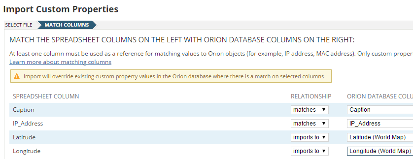
- Click Import.
- Optional: Verify that the values were imported successfully.
- Click Settings > All Settings, and click Manage Custom Properties.
- Select Longitude and Latitude and click View / Edit Values.
- Add the Longitude (World Map) and Latitude (World Map) columns.
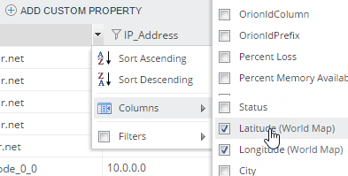
The values for Longitude (World Map) should match the Longitude values, and values for Latitude (World Map) should match the Latitude values.
You can now see the nodes in the Worldwide Map, as specified by the Longitude and Latitude (World Map) properties.